vik dhillon: phy105 - spherical geometry - position on the earth's surface
position on the earth's surface
To see how some of the spherical geometry described above can
be put to good use, let us look at an everyday example - the
measurement of position and distance on the surface of the Earth.
The rotation of the Earth on its axis presents us with an obvious
means of defining a coordinate system for the surface of the Earth.
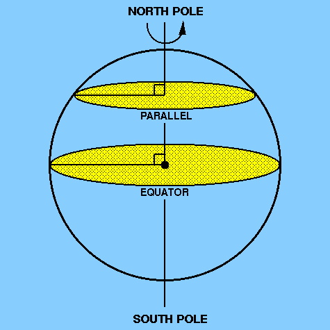
The two points where the rotation axis meets the surface of the Earth
are known as the north pole and the south pole and
the great circle
perpendicular to the rotation axis and lying
half-way between the poles is known as the equator. Great circles
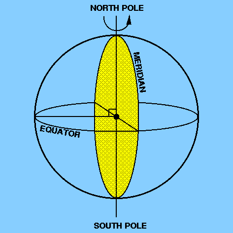
which pass through the two poles are known as meridians
and small circles which
lie parallel to the equator are known as
parallels. Figure 5 and
Figure 6 illustrate the above definitions.
figure 5:
the north pole, the south pole, the
equator and
a parallel
figure 6:
a meridian
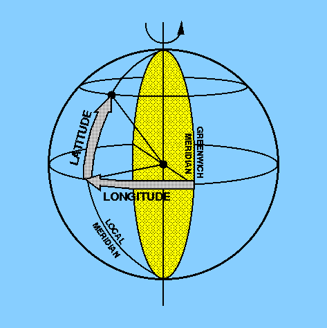
Any point on the Earth's surface can then be defined by two coordinates,
latitude and longitude, as illustrated in Figure 7.
The longitude of the point is measured east or west along the equator and
its value is the angular distance
between the local meridian passing through the point and the Greenwich meridian
(which passes through the Royal Greenwich Observatory in London).
Because the Earth is rotating it is possible to express longitude in time
units as well as angular units. The Earth rotates by 360° in about 24
hours. Hence, the Earth rotates 15° of longitude in 1 hour, 1° of
longitude in 4 minutes, 1´ of longitude in 4 seconds and
1´´ of longitude in 1/15 second.
The latitude of a point is the angular distance north or south of the equator,
measured along the meridian passing through the point. A related term is the
co-latitude, which is defined as the angular distance between
a point and the closest pole as measured along the meridian passing through
the point. In other words, co-latitude = 90° - latitude.
figure 7:
latitude and longitude
Distance on the Earth's surface is usually measured in nautical miles,
where one nautical mile is defined as the distance subtending an angle of one
minute of arc at the Earth's centre. A speed of one nautical mile per hour is
known as one knot and is the unit in which the speed of a boat or
an aircraft is usually measured.
Note that because the Earth is not a true sphere (it is actually a
geoid) the actual measurement of position and distance on the
Earth's surface is more complicated than outlined above - see pages 47-50
of Roy and Clarke - but the above description is accurate enough
for our purposes.